Driving the Alaska Highway? An Eye-Opening 6 Days!
Updated August 2003
Driving the Alaska Highway aka the Alcan (short for the Alaska Canada Highway)is a bucket list item for many RV’rs and a necessary drive for anyone moving in or out of Alaska. Think military families, we met a lot of them on the Highway.
This article may contain affiliate links. We may earn a commission if you use these links to buy products or services. Please see our disclosure policy for full details. Thanks.
Why the Alaska Highway is in Canada
The idea of a highway spanning from the continental US, through Canada to Alaska was first brought up in the early 1920s. For reasons both economical and political, it took a while for the idea to gain traction.
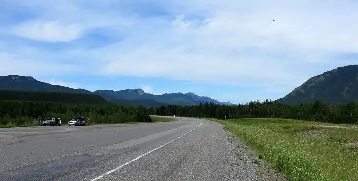
It wasn’t until World War II and the threat from Japan in the Pacific that priorities changed and both countries agreed on the value of having the highway.
However, it should be noted that while Canada gave up the land, they insisted that the US bear the cost and construct the road. Additionally, Canada required that the highway, and any facilities built for support, be turned over to Canada after the war ended. And thus, the Alaska Highway was born.
Our Reason and Plan for Driving the Alaska Highway
We are driving the Alaska Highway this summer because my SIL is moving to Bend, OR. And this is the road you take to and from “the Lower 48” to get in or out of Alaska. The Highway runs through Canada from the Alaska / Canada border near Tok, Alaska, to the Northern US / Canada border.
When mapping out our drive on the Alaska Highway, we use TripTik, an excellent mapping service AAA has put together. The directions and maps this service provided have been accurate, saving us a lot of guesswork.

There are a few different border crossings from Canada to the US. We chose Abbotsford, British Columbia, which will put us in northern Washington just a little east of Interstate 5. We could go over to Vancouver, CA, and cross closer to I-5, but these crossings usually have more traffic and often have over an hour-long queue.
Usually, driving the Alaska Highway is a trip you want to take your time on. The scenery and wildlife are phenomenal. But we are up here to move my sister-in-law (SIL), her golden retriever (Ally), and all their belongings to Bend, Oregon. Over the next five and one-half days, we will traverse more than 2,700 hundred miles.
Where to Stay on the Alaska Highway?
Much of the Alaska Highway is just a two-lane open road. If you are in an RV or Camper, where you sleep is taken care of, but where you park is not. If you are in a car or truck, you need to find a bed.
Additionally, if you need “Pet-Friendly” accommodations. (We all think of Ally as part of the family, but most hotels still just see a really big dog.) You should plan each night’s lodging ahead of time as best as you can. In most years, summer is “High Season” for driving the Alaska Highway. Campgrounds, RV parks, lodges, hotels, and motels fill up fast.
To find lodging, we use various resources: TripAdvisor, Booking.com, AAA, and Yelp. Whenever possible, we try to read as many reviews as we can, explicitly looking for “traveler photos.” We have found the photos from the establishment don’t often show the real story.
Arriving in Alaska
Usually, people arriving in Anchorage in the summer are starting an Alaska cruise. This is something we’ve done a couple of times in the past and I highly recommend it. But this time we’ll be seeing Alaska on the road.
It’s Wednesday afternoon. My SIL picks us up at the airport, and we head to the U-Haul dealer to pick up the truck. The day before, SIL realized the 15-foot truck wasn’t going to cut it and upgraded to the 20-foot.
We get the U-Haul and head to the house to start the loading. There is only tonight and tomorrow to get all the goods packed and loaded in the cargo area.
We plan to leave on Friday morning; hopefully, around 7:30 am. If all goes well on this first segment driving the Alaska Highway, this will put us at the border early on Friday in case any issues arise entering Canada.
Day 1 – Chugiak, AK to Beaver Creek, Yukon, Canada
Unfortunately, we ended up leaving out of Chugiak about three hours later than planned. We are driving the Alaska Highway east towards Canada on the Glenn Highway (Alaska Highway 1). After passing through the Palmer/Wasilla area, we finally feel like we are out on the open road.
Note, that this highway is not in great shape. Take care and go a bit slower than normal to avoid some of the crater-like potholes.
The views are panoramic. To the south is the Matanuska Glacier. SIL took us to the glacier a few years ago, but that was in the winter, and with all the snow, you really couldn’t feel and see the enormity of Matanuska.
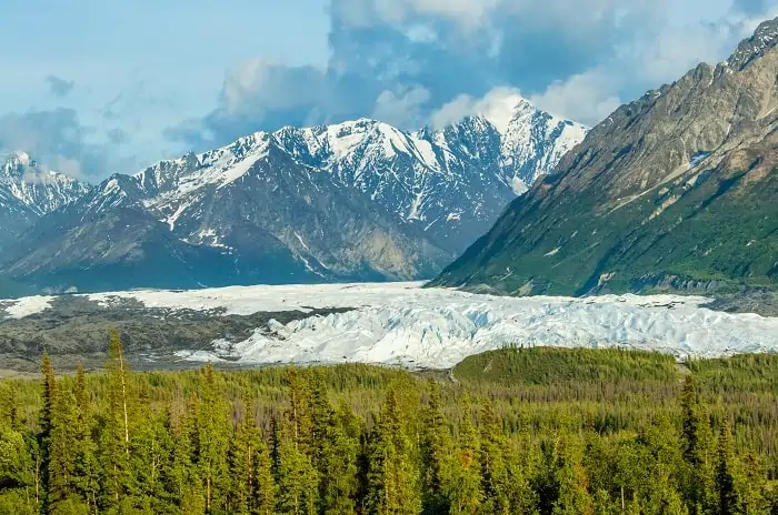
Matanuska is a valley glacier that is 27 miles long and four miles wide. While driving along the Highway, you get fantastic views of the glacier for over half an hour.
We also expect to see local wildlife and keep our eyes peeled. Summer is the time of year you find moose and bears near the Highway. We are not fortunate on this leg of the drive; no animals are hanging out in view.
It is helpful to plan your fuel stops. Our first planned stop is in Glenallen, about 160 miles into our drive. We will gas up again in Tok, AK before we head for the Canadian border about 70 miles down the road.
Our stop for the night is in Beaver Creek, just 20 miles past the border. This is 90 miles from our fuel stop, but gas is much cheaper in AK than in Canada.
It can be a long way between gas stations. And the more remote the station, the more expensive the gas. When driving the Alaska Highway, a good rule of thumb is to drive on the top half of your tank (filling up before you get too low).
Crossing International Borders
It is 7:58 pm when we pull up to the crossing. We’ve lost an hour due to the different time zones between Alaska and Canada. There are many cars to the right of the customs station with their drivers and passengers just sitting there.
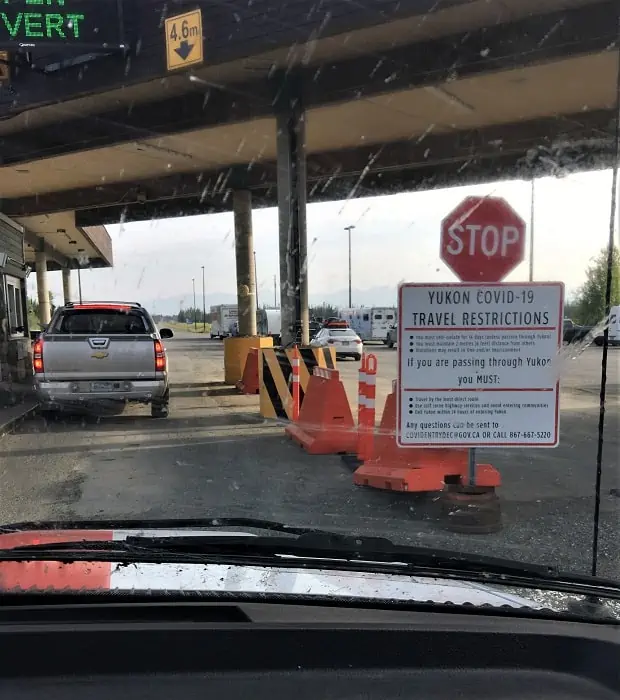

Before leaving, we spoke to Canada Border Control to find out what we would need to cross. We were told to have all of the necessary documents to show this was a permanent relocation, and we do. Also, who goes on a holiday in a 20-foot U-Haul truck?
After waiting for permission to enter Canada, we are finally free to go. We drive the last half mile to Buckshot Betty’s, hoping we still have a room.
Maybe the Only Place to Stay in Beaver Creek
We chose Buckshot Betty’s because my SIL stayed here a few years back and liked the owner. Hopefully, there has not been a change of ownership, and they are still as considerate to late-night travelers.
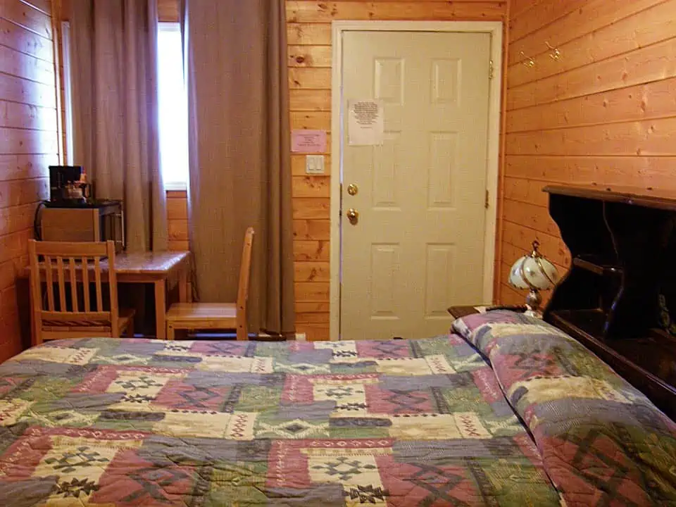
I love Buckshot Betty… When we arrive just after 1:00 am, we find a note on the front door of the lodge, letting us know where our cabins are. How wonderful of her to make sure we had rooms!
We are assigned two cabins, one for SIL and Ally and one for me and my DH. The cabins are small, clean, and cozy and have everything you need. Each cabin has a frig, microwave, coffee maker, and thankfully its own bathroom.
SIL tells us that the food here is terrific. But we arrive too late for dinner and leave too early for breakfast. It’s too bad we didn’t get to sample the dining experience.
End of Day One – 427 Miles; Wildlife 0; Border Control 1
Day 2 – Driving the Alaska Highway Yukon Territories
Beaver Creek to Watson Lake, Yukon Territories, Canada
For us, this is the official start of driving the Alaska Highway. The roads on this section of the Highway are quite rough. There is a lot of construction underway on the Highway. Road work is typical in summer. They need to make repairs now so the roads will be passable in winter. Two stretches of the Highway are nothing but gravel and run 12 miles each.
On more than one occasion, we hit potholes so large we were worried that we might blow out a tire or even break an axle. Good thing we rented and brought a satellite phone along, there is no cell service for most of our route. Fortunately, U-Haul builds its vehicles robustly, and we don’t need to call for help.
The highway here in the Yukon continues to be a two-lane road; one lane going south and one lane going north. There are some very high mountains off in the distance Mt. Logan to the southwest of the Highway is nearly 20,000 feet at its summit. Kluane Lake is on the east side of the Highway offering us lovely water views.
We stop in Haines Junction to fuel up the trucks. My husband (DH) and I grab a meat pie and coffee at the shop attached to the gas station. You may think this is crazy or possibly a food disaster, but the shop is clean, and the food is freshly prepared. Canada gas stations (and rest stops on the road) seem to be way more sanitary than those in the US.
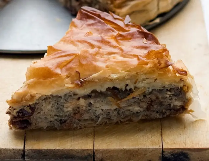
I haven’t eaten anything but snacks since breakfast on Friday. I scarf down my meat pie very happily! SIL is not having any strange food; she is not an adventurous eater. SIL just gets coffee.
Mid-Day Break – Whitehorse
Whitehorse is the capital and only city of the Yukon and is our midway stopping point today. We all need to get out of the trucks and walk around a bit.
SIL wants McDonald’s, and Whitehorse is a town big enough for Micky D’s. SIL takes a spin through the drive-through and picks up burgers for herself and Ally. DH and I make use of the facilities. Then we head on down the road.
The roads are better now. We drive alongside many lakes and rivers for this stretch of the Alaska Highway. The waterways mean the surroundings are green and lush. Wildflowers grow along the roadway.
The waterways also mean there are plenty of flying insects. Every time we get out of the truck, we are swarmed. We brought and used Off-Deep Woods, which has 25% DEET, but we still get quite a few bites.—Also, we have a new road game: smashing bugs!
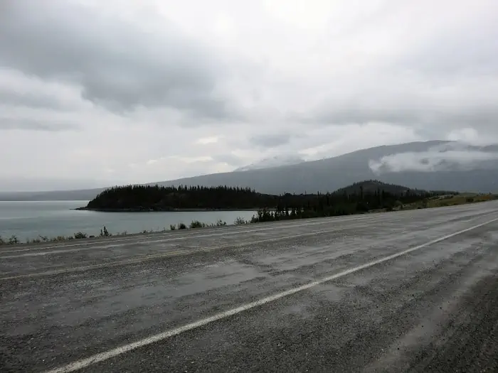


For the most part, there are no other cars. Even though we are keeping to our 60 mph (100 kph) schedule to meet our travel needs, we enjoy the scenic drive.
At one point, a moose jumps out into the road ahead of us, and then darts back into the forest on the other side. A few miles later, we pass a black bear searching for grubs or berries. The bear seems small to me, and I wonder if it’s a cub, but there is no mama bear around. We don’t see much wildlife. It’s raining this afternoon, and that is likely keeping most of the animals “inside.”
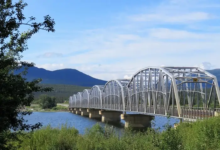
The rain clears as we get into the late afternoon. Just past Teslin, we cross the Nisutlin Bay Bridge. The bay and the bridge that crosses it present a great photo op. I jump out to snap the photo.
Staying in Watson Lake
We finally arrived at Watson Lake at around 8 pm. This is good since we’ve been on the road since about 8 am.
Watson Lake is probably the hardest town to find a place to stay. The hotel, with the best recommendations from travelers, does not accept pets. The other hotels are generally not recommended. Reviews for both the 2nd and 3rd choice lodgings mostly said do not stay here. But we had to make a choice, and we chose Andrea’s.
Andrea’s provided everything we needed for the night. The room is clean and spacious, but not fancy. All the amenities were there, TV, frig, and coffee set up. When we check in we are each given the wifi password that entitles us to one free gig of usage.
There is a restaurant on-site and a grocery store, so any needs you have can mostly be accommodated. We found the front desk and restaurant staff to be helpful and considerate.
End of Day Two – 535 Miles (962 total); Wildlife: Moose 1, Bear 1, and Squirrel 1.
Day 3 – Driving the Alaska Highway
Watson Lake to Fort St John
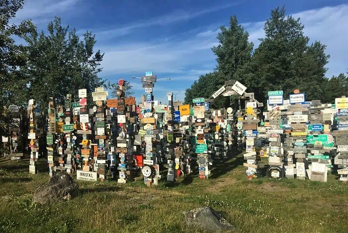
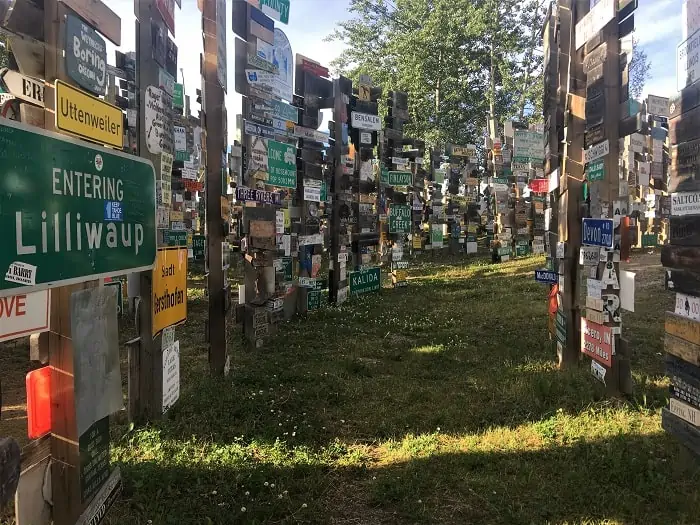
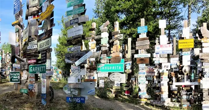
Watson Lake, we’re up early again, and it’s sunny this morning. I walk over to the”Signpost Forest” and wander through. SIL says she left a license plate here when she moved up 19 years ago. There have been a lot of signs added since then. We didn’t find her license plate.
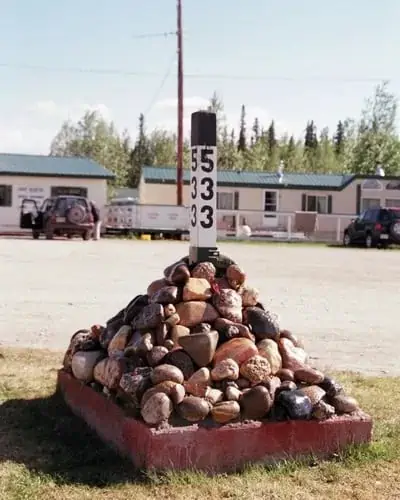
Time to move on, today is one of our longest days on the trip in terms of miles we need to cover. Because I want to see “MilePost -0-” of the Alaska Highway Drive, we make a quick detour to Dawson Creek.
Yes, we are still in British Columbia and have not yet traversed all of Canada, but this is where the photo op for Mile -0- is.
Folks in Dawson Creek are quite friendly and must be used to tourists jumping out of their cars to take this photo. Several people stopped their cars, got out and a) offered to take our photo; b) made sure we were not lost.

Our next stop is at the Coal River Lodge and RV Park in Muncho Lake to gas up. We take a few minutes here to get some coffee and fresh-made apple strudel and chat with the owners of the shop.
Where’s All the Wildlife?
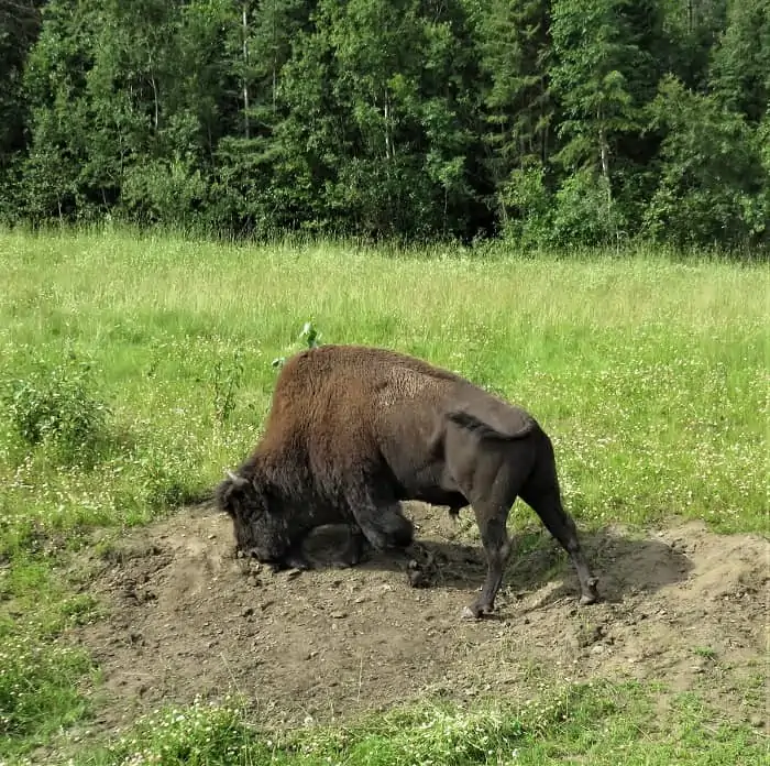
There are supposed to be enormous herds of wild Bison in this area. So far, we’ve only seen one lone Bison. The shop owners are surprised we haven’t seen more Bison. Mrs. Shop Owner says the day before they had 60 bison or more on their RV Lot. In total, we see only three.
DH slows down when we see a Bison on the side of the road, giving himself a dirt bath, and I snap a few photos. Just after this, on the other side of the Highway, we see a colossal Bison just calmly walking toward us. I know we are in a big truck, but I am pretty sure the Bison could take us out if he wanted.
The terrain is changing as drive down this part of the Alaska Highway. Mountains are getting higher and rockier. Trees are taller and broader, and there is more variety in the forest. Here is where we see the most wildlife.
There is another bear on the side of the Highway, and just after leaving a rest stop, a juvenile moose runs down the road. Further along, the landscape is rockier, and alongside a river, we see five Pronghorn Antelope.
Coming into Fort St. John, we notice there are many signs of oil work being conducted in the area. The landscape near the Highway is lush and green, but at every crossroad, we see signs for petroleum companies. So we are not surprised to find that the city is known as British Columbia’s Oil and Gas Capital.
Great Lodgings in Fort St. John
It seems we always arrive at our hotel for the evening around 8:00 pm. Today is no different. The options for hotels in St. John are pretty good, probably due to all the industry around the area. Most of the big brands are here, from Super 8 to Best Western to Microtel by Wyndham. And of course our choice, Home2 Suites by Hilton.
Home2 Suites is by far the best accommodations we’ve had on the road so far. DH is a Hilton Diamond member, so we’ve been upgraded to a suite. Our suite is perfect, and the shower is divine. Too bad we leave in the morning.
End of Day Three – 550 miles (1,497 total) Wildlife: Moose 1, Bison 3, Bear 2, Horse 1 and Antelope 8
Day 4 – Fort St. John to Williams Lake, British Columbia, Canada
For much of today, our drive on the Alaska Highway follows the Fraser River. This is the longest river in British Columbia, running for over 1,375 kilometers. For those of us in the US who never converted to the metric system, 1,375 kilometers is about 855 miles. In other words, it goes a long way.
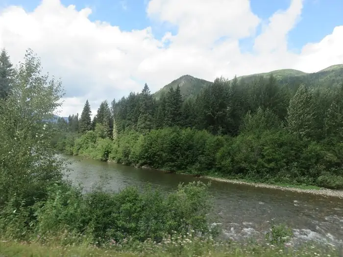
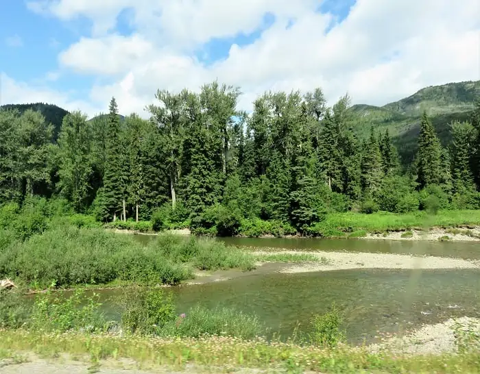
We are also basically straddling the Continental Divide in the Canadian portion of the Rocky Mountains. Eventually, the Fraser River heads west over to Vancouver to empty into the sea. But before that, we will need to head south.
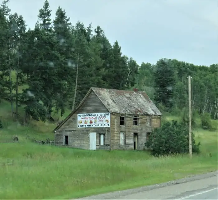
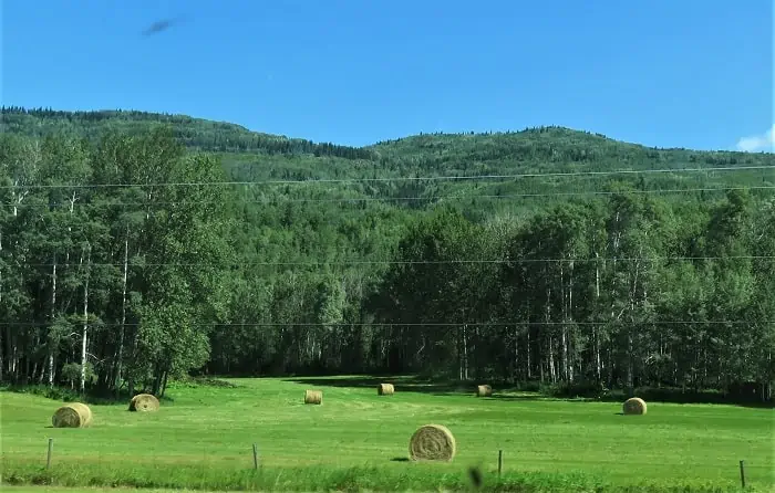
Our drive today is easy. The Highway is in good shape, and there are fewer hills to climb. When not adjacent to the river, the views are of farms, cows, sheep, and horses. We finally arrive in Williams Lake, which is quite a big city stop for us on this drive

Williams Lake Lodging
Again, no problems finding lodging here in Williams Lake. This is a good size city, the population is around 11,000. There is a Ramada, a Super I, and our choice for the night, the Best Western.
We chose Best Western for its location right on the Highway. But again, Best Western is a known commodity in lodging and provides all the amenities of mid-range hotel accommodation.
Throughout our journey, except for Andrea’s in Watson Lake, the hotel’s food services have been mostly closed due to the Pandemic and social distancing requirements. We can order food to be delivered for dinner. In the mornings, hotels have been offering a sort of “grab and go” breakfast. Yogurt, granola bars, apples, bananas, and coffee are typical.
I should say here that we are no longer driving the Alaska Highway; not since Dawson’s Creek. We are now on Canada Highway 97 – The Cariboo Highway. This is the route we will follow as it migrates to Canada Highway 1 – the Trans-Canada Highway that leads to Abbotsford.
End of Day Four – 446 miles (1,943 total) Wildlife: Only if you count farm animals
Day 5 – Saying Good-Bye to Driving the Alaska Highway
Williams Lake to Centralia, Washington, USA
As we load up for our drive today, we are elated, but it is bittersweet. We leave Canada today, realizing we were not able to stop and take in the wilderness that surrounded us as much as we would have liked. The time constraints placed on us by moving a household took the option of lingering away. But we come away with a great appreciation for the Alaska Highway.
Abbotsford is a small town, and similarly, on the US side of the border, we are “out in the boonies.” We work our way back over to the interstate (I5) and head south to our stop for the night, Centralia, WA, just south of the state Capital, Olympia.
End of Day Five – 484 miles (2,428 total)
Day 6 – entralia, WA to Bend, OR, Our Final Destination
This last leg of the journey is the shortest. Planned that way, so we arrive in Bend in time to unload the U-Haul at the mini-storage before it closes at 5:00 pm. It’s a quick ride from Centralia through Portland, and then we head east on I-84, the Mt Hood Scenic Highway.
This part of the drive takes us through the beautiful Mt. Hood National Forest. We stop at the summit for a quick stretch and a local farmer is there selling cherries and plums. I pick up a 3-pound bag for our snacking pleasure.

Turning south towards Bend on US 197/97, you start to see the change in the landscape again. The terrain now becomes the scrappy high desert that much of the western US is known for.
End of Day Six – 296 miles
The End – Driving the Alaska Highway – 2,724 miles
When originally built during World War II, it was finally possible to get from the contiguous United States (the Lower 48) to Alaska by land. The road has always been rough and challenging. Today the Alaska Highway is probably in the best driving conditions it has ever been, but it is still wild.


One Comment